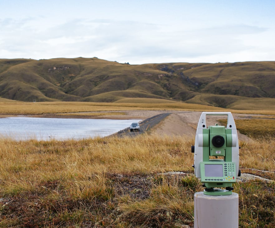
Surveying services include:
Topographical Surveys and Site Mapping
Topographical surveys involve Surveying the natural and built features within a specified area. We prepare a plan of the data with a 3D contour model. A Topo or site survey as it is often called is frequently required by architectural designers before they commence a house design. A topo survey is also highly recommended by local authority Building Control departments, as they now require more certainty about the accuracy of the relationship between a proposed building design and a property’s boundaries. CONTACT US
Unit Title Surveys and Cross-lease Surveys
These forms of subdivision tenure are applicable for multi-unit and multi-storey buildings respectively and define areas for exclusive and common use. Unit Titles are common and whilst cross-lease subdivisions are slowly being phased out they continue to have their place in limited scenarios. Each has a specific application and we will discuss the relative merits with you when evaluating your proposal.CONTACT US
Land Transfer Survey for Urban or Rural Subdivision
Once subdivision consent has been obtained (refer to our Planning page), an LT Survey is required to show the new lots and facilitate the issue of titles. This involves office and field survey works to calculate and peg the boundaries, before we prepare the title and survey plans (as part of a Cadastral Survey Dataset or CSD) for certification by Council and lodgement with Land Information NZ. CONTACT US
Boundary Redefinition Survey
These surveys often called a boundary marking survey are undertaken to mark the position of an existing boundary for a variety of reasons (ie. property purchase, new fencing, building or to assist in dispute resolution). CONTACT US
Legalisation Surveys
These surveys define parcels of land to either be acquired for a specific public purpose or their public purpose is to be stopped. A common case is to define new roads and close old roads during new or realignment road works. These surveys are generally undertaken for local and government authorities.CONTACT US
Building Setout and Certification Surveys
These surveys are undertaken to precisely set out or mark out points to assist with the positioning and construction of buildings and structures. Councils now require building work to be set out and certified by a Licensed Cadastral Surveyor as being in accordance with the building consent plans. CONTACT US
Easement Surveys
Surveys are undertaken to define the rights of one landowner to use part of the land owned by another for access or services (ie. Right of Way, Water easement, Electricity easement, etc). Only the creation of Right of Way easements requires Council approval.CONTACT US
Lease Surveys
The lease of land and/or buildings (particularly long-term) requires a survey and lease plan to be prepared by a Licensed Cadastral Surveyor.CONTACT US
Covenant Surveys
Covenant surveys are used to define an area that legally has some degree of restriction. This could include a restriction on activities to protect areas of significant natural landscape, habitat or archaeological/cultural sites. They are also used to define an area that could be subject to a height restriction or no build restriction to protect a property's views.CONTACT US
Precise Measurement and Monitoring Surveys
These surveys require specialist equipment, techniques and computer adjustment of measurements to determine often very small movements of land and/or structures. Movements of a tenth of a millimeter are detectable. This work has a particular application in monitoring land stability and environmentally related movements of buildings and structures.CONTACT US
Hydrographic Surveying and Erosion Monitoring
These surveys are undertaken to map the bed of a river, lake or sea, or to monitor the effects of erosion over a period of time. The work invariably involves the use of boats, GPS and depth-sounding equipment.CONTACT US
Farm Mapping
Farm maps can be generated from actual drone surveyed data or from historic aerial photography depending on the accuracy required. A farm map based on actual data is similar to a topographic survey which locates specific requested features. A plan is then prepared using the surveyed data. Farm maps from aerial photos have a lesser accuracy and show large-scale detail. The plan produced can be updated to record any changes and is a useful farm management tool.CONTACT US
Aerial Surveying
Terramark operates a DJI Mavic 300 RTK drone. This drone provides the opportunity to survey large areas of land by air far more efficiently than by traditional land Surveying methods. Our current payloads include the Zenmuse L1 LiDAR & RGB sensor and the Zenmuse P1 Full-frame Photogrammetry camera. This combination enables us to provide a wide range of Aerial Surveying services.CONTACT US
Forestry mapping
The Surveying of farm woodlots and areas of commercial plantation for forestry rights and carbon farming application.CONTACT US
.jpg?_cchid=9a9d429c7d46cb35a4dc5e638a79d8bd)
